Houston–Canal Low Traffic Neighborhood Study
Senior thesis · The New School · Spring 2026
How could streets between Houston and Canal support neighborhood life while retaining necessary vehicle access?
I investigated whether a low traffic neighborhood could be a suitable model for this part of Lower Manhattan. The study brings together pedestrian demand, crash exposure, transit access, and international precedents to propose a phased approach.
Read the full thesis (PDF · 19 pages · 8.2 MB) ↗
The problem
The thesis examines a mismatch between pedestrian activity and the space allocated to vehicles. Its focus is on reducing through-traffic on interior streets while preserving access for residents, deliveries, and emergency services.
My research approach
I reviewed New York’s public-realm policies and precedents from London and Tokyo, then compared neighborhood-level indicators using NYCWalks modeled pedestrian volumes, NYPD collision data, MTA station and ridership data, and land-use and census geography.
These sources address three different questions: where people walk, where collision harm is concentrated relative to pedestrian activity, and where transit offers an alternative to driving.
What the analysis found
| Indicator | Reported rank |
|---|---|
| Pedestrian intensity | 3rd |
| Crash exposure | 2nd |
| Transit access | 3rd |
Source: thesis Tables 1–3, pages 12–13. These are neighborhood-level comparisons, not block-level measurements or predicted improvements from an intervention.
Together, the indicators support the study’s recommendation to investigate the corridor as a pilot area. They do not establish the effects a future intervention would have.
A three-stage proposal
- Recurring Open Streets. Start with one block, then expand to a street and potentially the corridor. Use the pilot to examine public response, traffic rerouting, business effects, and emergency access.
- A low traffic neighborhood. Introduce modal filters to limit through-traffic while maintaining local access, drawing on London’s approach.
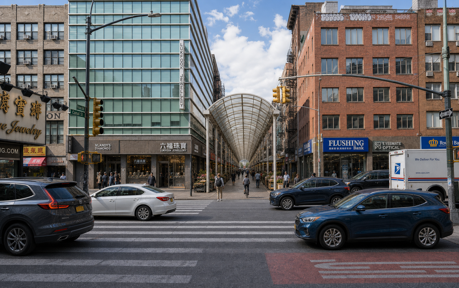
- A public market corridor. Explore how a calmer street network could support public life and local commerce, inspired by Japanese shōtengai.
How I used AI
I used Codex to help build analysis tools. As documented in the thesis, numerical calculations were performed by GeoPandas, PySAL, and scikit-learn rather than generated by the language model. ChatGPT was also used to visualize a possible public market corridor.
Limits and next steps
The study relies on secondary datasets and modeled pedestrian volumes, rather than original field counts. It did not include community engagement. Neighborhood-level findings therefore need to be followed by street-level observation, consultation, and testing of access and traffic impacts before implementation.
What this project demonstrates
This project connects my urban studies background with my product design interests: framing a complex problem, comparing evidence, making tradeoffs explicit, and proposing a sequence of tests before committing to a larger intervention.